Identify and mitigate sustainable sourcing risks across your supply chains
Make evidence-based decisions for commodity sourcing and compliance.
Book a demoTrusted by the world’s leading companies


From risk detection to defensible compliance
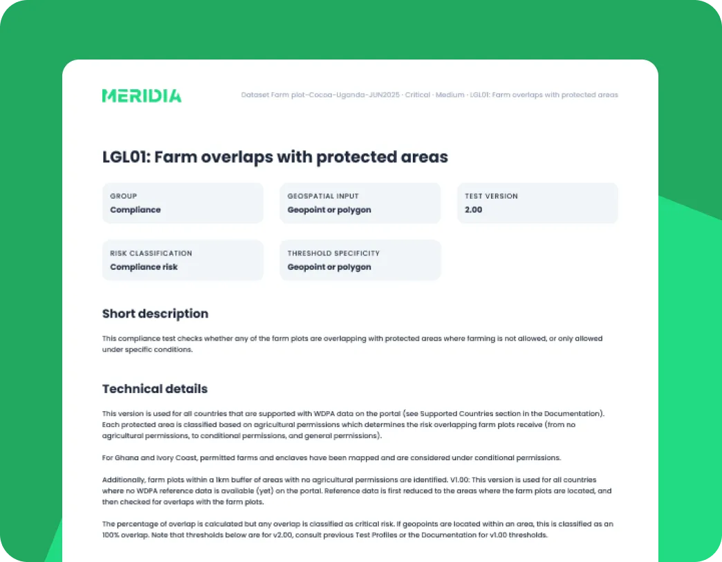
With Verify, you don’t just identify critical risks; you generate auditable, evidence-based risk assessments that stand up to regulatory scrutiny. Focused on legality, deforestation, and data quality.
Built on an EY-audited methodology and tailored to 40+ origins, Verify enables you to prove compliance with confidence across your supply chains.
Verify is available as a subscription via our API or our secure, easy-to-use portal.
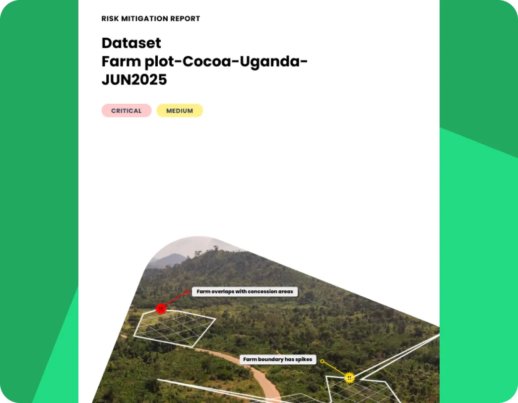
Reduce the EUDR admin burden through structured, proactive risk management
Targeted remediation for high-risk suppliers
Enable your field teams and suppliers to mitigate risk on the ground with concrete actions for each critical risk and step-by-step guides. All in a format that's easy to follow, leveraging our decade of field experience.
Designed for fast adoption
We prioritise ease of use, enabling teams without GIS expertise to generate reliable, repeatable assessments and reports.
Visual inspection tool to avoid costly field visits
For deforestation, our visual inspection (powered by Sentinel‑2 imagery) with year‑by‑year switching lets you zoom in, make an assessment, and capture evidence without leaving Verify.

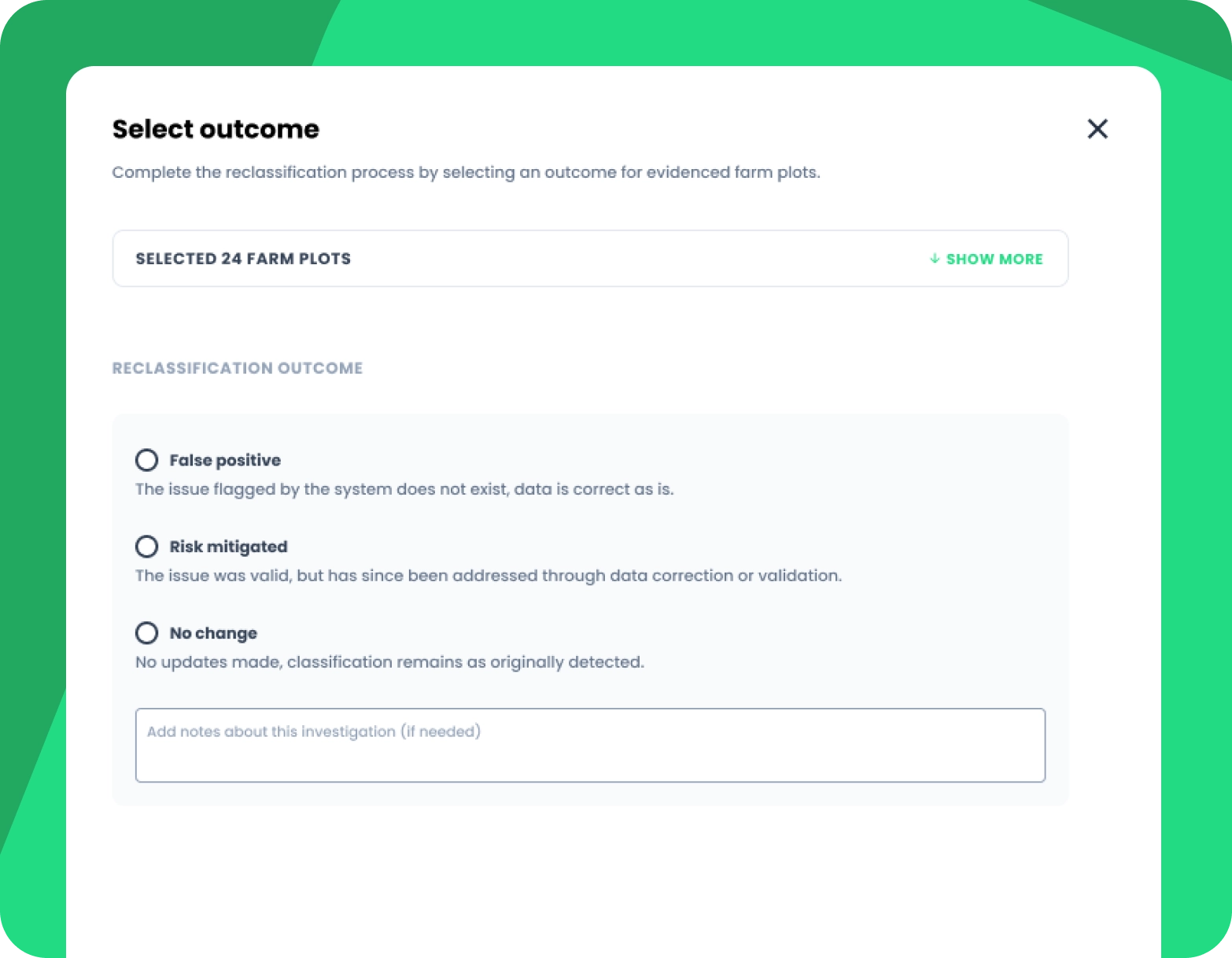
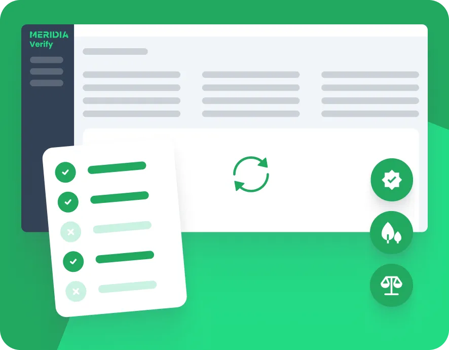
Reclassify risk scores as you gather evidence
You can flag and reclassify Verify risk scores from critical to low by uploading evidence, all of which is supported by a full audit trail. This makes risk decisions easier to manage and defend at scale whilst maintaining full accountability. Perfect for when you’re audited internally or externally.
Supplier data access and uploads
Suppliers can upload farm and sourcing data directly into the portal, which streamlines collaboration and data collection. Their access rights can be controlled, ensuring contributions are accurate while sensitive information stays protected.

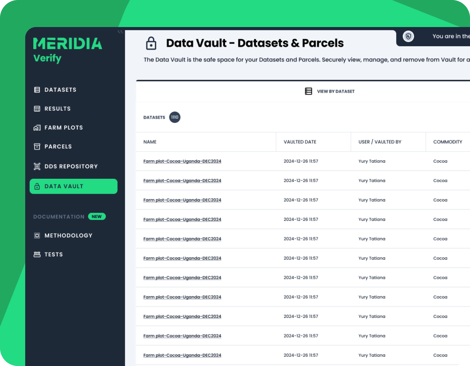
Audit-ready data vault
The data vault ensures your selected farm plot data is audit-ready. You can store data for five years, selectively grant access to authorities, and control visibility per origin and commodity to prevent oversharing.
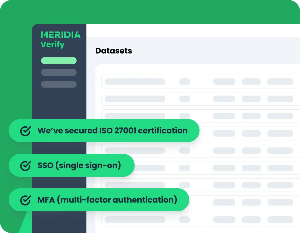
Verify’s enterprise-grade security
Protect your sensitive supply chain data with our robust security measures, demonstrating our commitment to maintaining the highest information security standards.
ISO 27001 certification
SSO (single sign-on)
MFA (multi-factor authentication)
Exceptional customer experience
Customers benefit from proactive support and advice from domain and GIS experts who understand both compliance and operational realities. This ensures smoother adoption of Verify and rapid resolution of any issues.

Discover Meridia Verify®
A best-in-class methodology – built on rigour and expertise

EY-audited
In accordance with the stringent ISAE 3000 standards.

Built on over a decade of deep field experience
Tested and refined in real-world conditions.
Fully transparent & versioned
So you always know precisely which tests and which thresholds were applied.

Advanced geospatial science & public and commercial maps
With insights from local actors to tailor risk assessments by origin, reflecting specific laws.
TRACES-ready
Verified data is accurate and consistent & fully compatible with the TRACES system.
How Verify supports its users
“At Volcafe, we have chosen to partner with Meridia to verify that our farm-level data is of robust quality, to support us in the identification of high-risk farms, and to refine our mitigation strategies.”
Discover Meridia Verify®
Book a demoFAQs
Meridia Verify identifies risks associated with deforestation, data quality, legal issues (including protected areas and indigenous rights), and environmental compliance across supply chains. We also offer traceability risk assessment as a consultancy service.
Verify provides real-time risk assessments tailored to commodity, region, and supplier, helping businesses identify and mitigate risks.
Yes, suppliers can upload farm and sourcing data with controlled access rights to ensure data accuracy and protect sensitive information.
Users can flag and reclassify farm plots directly in the query builder, adding evidence and audit trails to support transparent and defensible risk decisions.
The data vault stores compliant and non-compliant data separately for up to 5 years, enabling selective, secure access for auditors and authorities while maintaining compliance with data privacy standards.
Yes, Verify is designed for ease of use with intuitive workflows, quick setup, and automated verifications, making it accessible to teams without GIS expertise.
Meridia Verify is ISO 27001 certified, ensuring enterprise-grade security to safeguard your sensitive supply chain information. Verify also has SSO (single sign-on) and MFA (multi-factor authentication).
Customers receive proactive support from domain experts, including training, onboarding assistance, and ongoing collaboration to refine risk assessment processes.
Verify’s methodology is EY-approved, independently audited under ISAE 3000 standards, and fully documented to ensure transparency, traceability, and reproducibility in line with international frameworks and regulations.